
Fernley ZIP Code Directory Coverage
The verified ordinary postal starting point is 89408. City and Census material use it for Fernley addresses, while the exact extent of a ZIP Code must be checked against a specific USPS result. That distinction matters because postal routing is built for delivery, not for proving a municipal boundary. No official capture established another ZIP for ordinary Fernley street delivery. A ZIP result may identify a valid mail address without determining the parcel’s city, county tax, fire, Sheriff, or utility layer.
| ZIP | Areas Covered | Post Office | Notes |
|---|---|---|---|
| 89408 | Fernley city and Fernley postal addresses, subject to USPS address confirmation | Not located in the official capture | Verified ordinary Fernley ZIP; ZIP is not a city-limit map. |
| 89409 | Not verified as Fernley street delivery | Not located | A third-party reference raised a possible PO-box or nearby-postal question. Do not claim coverage until USPS confirms it. |
The unverified 89409 entry is a research gap, not a second Fernley service claim. It should not be used for an ordinary address, a population count, or a post-office name. USPS output for the actual address is the deciding source.
Verify a Fernley ZIP Code
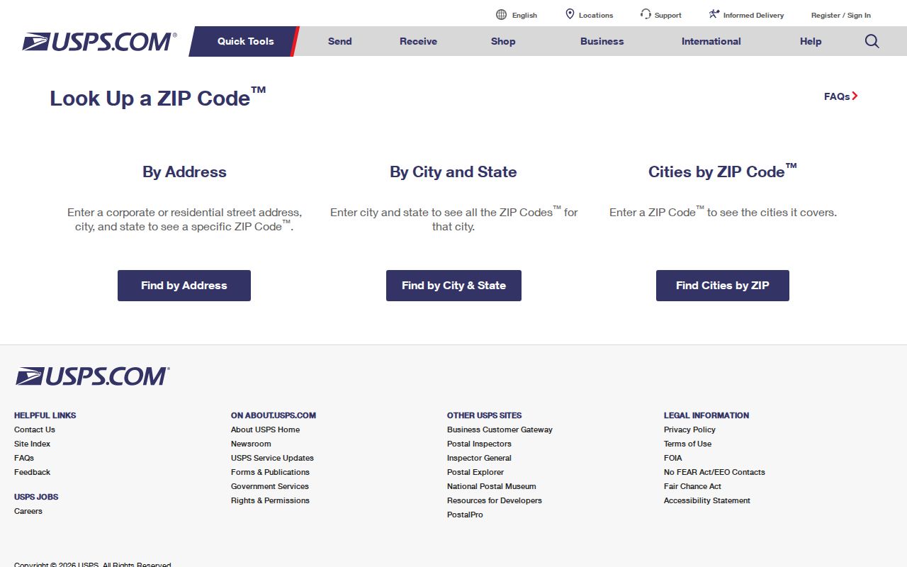
USPS ZIP Code Lookup is the direct check for a delivery address. Use the full street number, street name, Fernley, and Nevada. The result should be copied exactly, including any ZIP+4 when it is supplied. Repeat the search when an address has a directional street prefix, unit, rural-route notation, or a different mailing city. A city name entered with a ZIP can help validate a general postal association, but the complete address result is better for a real delivery question.
- Open USPS ZIP Code Lookup and choose the address search.
- Enter the property’s complete current address and Nevada city information.
- Record the returned ZIP or ZIP+4, but do not display another person’s full delivery address unnecessarily.
- Use city GIS and the assessor when the next question concerns city limits, APN, or a parcel rather than mail delivery.
The official USPS lookup capture below is the appropriate postal tool for the Fernley ZIP code directory.
USPS verifies postal routing. It does not adjudicate easements, surveys, parcel lines, or residency. When a letter uses a ZIP that differs from a tax or assessor mailing field, ask whether it is the physical address, a mailing address, a post-office box, or a historical record entry before treating it as a conflict.
Fernley ZIP and City Limits
Fernley became entirely part of Lyon County after the 2005 county boundary change. Older records can still carry Lyon or Washoe County language, so an early deed, census entry, or newspaper address should be searched in both places when a current Fernley address does not resolve the trail. That county history is separate from postal service. A parcel can have a Fernley mailing name while a city-boundary, service, or tax question calls for a different map.
City Engineering and GIS maintains public boundary, ward, precinct, street-index, and regional maps. It is at 595 Silver Lace Boulevard, with Engineering/GIS at 775-784-9910 and the GIS Technician at 775-784-9826. Use those contacts for an address request or a GIS data request. The Postal Service locator for the 89408 station was not established in the official research, so no station name is supplied here.
- ZIP+4
- An added four-digit delivery segment used by USPS. It is more specific for mail routing but is not a parcel identifier.
- PO box
- A postal delivery box. It may differ from the physical location and does not establish ordinary street coverage.
- Carrier route
- A USPS delivery grouping. It is a postal operation label, not proof of a neighborhood or city boundary.
Lyon Tax Search and ZIP Fields
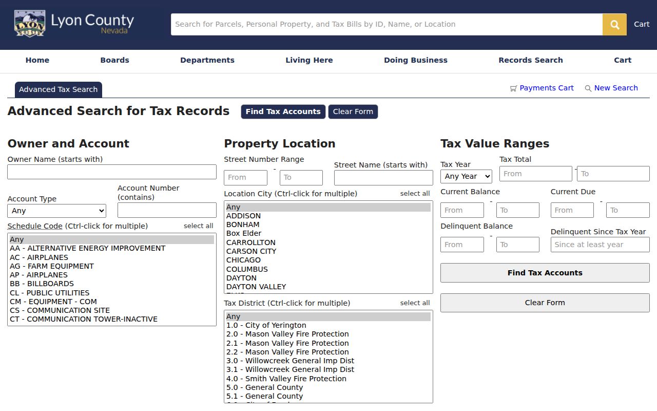
The Lyon County assessor and tax paths work best from the details already attached to a property. Their visible searches use owner name, account information, street number range, street name, city, tax district, tax year, balance, and related parcel fields. Neither inspected form visibly offered a ZIP filter. The GIS parcel data can expose a mailing ZIP field, called PZIP, after a parcel is found. That is useful evidence about tax correspondence, but it is not a street-delivery search and does not establish an occupant.
| Location City | A city filter available in assessor and tax workflows, distinct from a postal ZIP. |
|---|---|
| Street number and name | Useful for a property or street slice when ZIP is not an offered filter. |
| APN | The parcel number that ties the assessor, GIS, and recorder trails together. |
| PZIP or mailing ZIP | A GIS or record field for tax correspondence, not a proof of physical delivery or occupancy. |
| Tax district | A county assessment layer that should not be equated with postal service geography. |
Lyon’s tax search shows the address and tax-field approach used when a ZIP query is unavailable.
Begin with city and street fields, then inspect the returned parcel and mailing values. The assessment record should be read with the date shown by the office because a tax statement can still be mailed to a former owner while a recent transfer is being processed.
ZIP Code Registry Limits
Nevada’s public sex-offender registry includes a ZIP search mode, along with name, vehicle, and address-distance tools. That feature is a statutory registry search, not a way to display people or addresses in the Fernley ZIP code directory. Registry information has public-tier limits and conditions of use. It must never be used to harass, injure, catalog, or distribute information about a person.
Use the Nevada registry conditions page to read its current restrictions before running any official search. No registry image is used because the assigned capture did not succeed. My Voter File is also not a ZIP-browse tool; it is an identity-gated check. In both systems, a ZIP may be a search option without creating a lawful local roster.
Fernley ZIP Address Layers
Keep three property identifiers together when an address has changed or old records use a different place name. The situs is the physical location used by assessor or GIS. The tax mailing address is where correspondence is sent. The legal description and APN identify the land itself through a lot and block, subdivision, section-township-range, or metes-and-bounds description. Older recorder instructions may use an eight-digit parcel number without dashes while current GIS uses a formatted APN such as 021-581-03.
A recorded deed or plat controls legal land detail, while an assessor map is an assessment tool rather than a survey. For questions about access, encroachment, setbacks, or floodplain status, route the request to Recorder, Building, Planning, or the appropriate agency instead of relying on a ZIP map. Note: city and postal names are useful search variants, but neither replaces the APN or legal description.
Fernley Postal Search Gaps
Some ZIP questions cannot be answered from the captured sources. An official USPS location or station name for 89408 was not exposed, and no official postal result confirmed 89409 as a Fernley-serving post-office box or nearby postal code. Those omissions should remain visible. A city address using 89408 does not identify the particular post office behind the route, and a third-party ZIP listing is not enough to expand ordinary Fernley coverage.
For a current station question, verify the address with USPS ZIP Code Lookup and then use the USPS Post Office Locator live. For an old address, compare its street spelling, postal city, parcel APN, legal description, and the dated county or city record. A researcher should note the source and date of each postal result because delivery geography can change. The safe conclusion from the research is narrow: 89408 is the verified normal Fernley ZIP, while 89409 remains unverified for ordinary Fernley delivery.
Do not use a ZIP alone to decide whether a place is inside Fernley municipal limits. The City Engineering map, assessor Location City field, and a current boundary map address a different question from postal delivery. County tax records can use the parcel’s assessment address and district, while emergency, fire, utility, and Sheriff services follow their own coverage layers. When an agency form asks for a mailing address, preserve the USPS result exactly and keep it separate from the parcel’s situs and legal description.
Fernley Postal Geography History
Fernley’s location names developed before the modern city. The Southern Pacific siding appears in a 1904 timetable, followed by telegraph and wye facilities in 1905. Railroad, highway, canal, irrigation, and later municipal layers can cause a historical address to appear with a station, township, rural route, or county label rather than the current city and ZIP. The Newlands Project and Truckee Canal are visible local geography that can separate a parcel pattern from a postal description.
City population figures are also not ZIP figures. Census QuickFacts reports Fernley city as 22,895 people in 2020 and an estimated 26,214 on July 1, 2025, but neither figure describes a postal ZIP. Search older materials with Fernley, Lyon, Washoe, township, station, canal, and rural-route variants when the date warrants it. That approach preserves the history without claiming a fixed postal boundary that the research did not verify.
Practical check. Use USPS for delivery, City GIS for city boundaries, the Lyon assessor for parcels, and the Recorder for the legal land record. Those tools answer related but different questions.